
Garmin GPSMAP 79s
4.2Editor score
Floats in water
IPX6 water resistant
20 hour battery life
Navigating open waters requires reliable technology to ensure safety and efficiency. Modern marine GPS units combine positioning with sonar and mapping to help skippers find their way. Choosing the right system depends on your vessel size and specific boating needs.
We evaluated ten leading models based on display quality, mapping features, and connectivity options. Each product was reviewed for ease of use, durability, and integration capabilities with other marine electronics. This list covers handhelds and fixed mounts for various budgets.
Every pick highlights unique strengths like rugged design or advanced scanning sonar. Prices fluctuate frequently so check current listings before purchasing. Our goal is to help you find the perfect navigation tool for your next adventure on the water.
4.2Editor score

4.7Editor score

5.0Editor score
As an Amazon Associate we earn from qualifying purchases.
This side-by-side comparison highlights the key specifications and capabilities of each unit. We focus on screen size, mapping capabilities, sonar options, and connectivity to help you decide which model fits your boat best.



The Simrad GO Chartplotter offers a robust multifunction display designed for sportboats and smaller cruisers. It combines GPS navigation with sonar support and radar options in one sleek unit. This system is ideal for boaters who want a comprehensive view of their surroundings without clutter.
We may earn a commission when you buy through this link, at no additional cost to you.
Key strengths include the included C-MAP Discover card with full-featured Vector Charts. You get custom depth shading and ultra-wide coverage in the US and Canada. The built-in GPS and Wi-Fi connectivity allow seamless integration with other marine electronics and NMEA 2000 systems.
While the HDI transducer provides clear DownScan Imaging for fish targets, adding radar requires an optional purchase. The interface is powerful but may require some learning time for new users. However, the ability to mirror the display to a tablet adds significant convenience on deck.
This unit is best suited for boat owners needing reliable navigation and fish finding in one package. If you value detailed charts and connectivity, this model delivers strong performance. Check current availability to ensure you get the right transducer bundle for your vessel.
Custom depth shading and bathymetric contours help you navigate shallow waters safely with greater confidence.
NMEA 2000 support ensures this unit talks easily to your existing engine gauges and autopilot systems.
We may earn a commission when you buy through this link, at no additional cost to you.
The Garmin ECHOMAP UHD2 94sv stands out with its bright sunlight-readable touchscreen and improved detail. It includes the GT56 transducer for traditional ClearVü and SideVü scanning sonars right out of the box. This makes it a top choice for anglers who need to see structure clearly.
We may earn a commission when you buy through this link, at no additional cost to you.
Built-in Navionics+ coastal charts provide integrated data for smooth navigation along the US coast. The Wi-Fi connectivity lets you wirelessly share sonar data and waypoints with other ECHOMAP units on the boat. You can also connect to Force trolling motors to control speed and routes directly.
While the display is excellent, the premium price might be steep for casual boaters. The transducer installation requires drilling but offers unmatched scanning capabilities. For those willing to invest in quality, the improved viewing angle and detail are worth the cost.
Ideal for center consoles and sportboats, this unit balances fishing features with navigation. The ability to wirelessly connect to your motor simplifies trolling significantly. Ensure your battery setup supports the continuous power draw during long fishing sessions.
Wireless control over your Force trolling motor lets you focus on fishing while the system handles navigation.
ClearVü and SideVü scanning provide detailed views of the bottom and fish targets for precise targeting.
We may earn a commission when you buy through this link, at no additional cost to you.
This Garmin model focuses on ultra high-definition scanning sonar with enhanced display optics. It supports Panoptix sonar for real-time viewing of fish and structure below and around the boat. The pre-loaded mapping ensures you can start navigating immediately after installation.
We may earn a commission when you buy through this link, at no additional cost to you.
The improved display optics offer better visibility in varying light conditions. Panoptix support allows you to see fish activity in real time which is a game changer for anglers. The system is designed to integrate smoothly into a wider Garmin marine network.
Premium features like Panoptix add to the cost and require compatible hardware. Users must understand how to interpret high-res sonar images effectively. However, the clarity provided is unmatched for finding specific fishing spots in deep water.
For serious anglers seeking the best underwater view, this unit is a strong contender. It fits well in larger boats where budget allows for premium sonar options. Check if your boat layout supports the specific transducer you plan to use.
Panoptix technology lets you watch fish move and react in real time below the hull.
Upgraded optics ensure the screen remains readable even when the sun is at a sharp angle.
We may earn a commission when you buy through this link, at no additional cost to you.
The 1243xsv is a high-end solution designed for expanding engine compatibility and system integration. It connects third-party devices via OneHelm digital switching and includes preloaded Navionics+ charts. This model is built for those who want to build a complete marine network.
We may earn a commission when you buy through this link, at no additional cost to you.
You can check built-in sonar features and control your marine experience remotely. The GMR 18 HD3 radar dome provides advanced situational awareness. Connectivity options allow you to link with various sensors for a holistic view of your vessel.
The price is substantial and installation often requires a professional due to complexity. It is overkill for simple boats but perfect for large yachts needing full control. The remote control feature adds significant convenience for monitoring systems while away from the helm.
Choose this if you are investing in a full digital ecosystem on your boat. It offers superior network connectivity that grows with your needs. Confirm your power and data infrastructure can handle the load before purchasing.
OneHelm switching allows you to manage power and signals for multiple devices from a single point.
Access critical boat data and control systems from anywhere on board for better management.
We may earn a commission when you buy through this link, at no additional cost to you.
This handheld GPS is rugged and designed to float in water with high-resolution color display. It comes preloaded with BlueChart g3 coastal charts for reliable navigation. The design includes scratch-resistant fogproof glass for durability in harsh environments.
We may earn a commission when you buy through this link, at no additional cost to you.
With support for multiple satellite constellations, tracking is reliable around the world. The built-in 3-axis tilt-compensated electronic compass shows heading even when standing still. A barometric altimeter tracks pressure changes to pinpoint your precise altitude accurately.
While the memory is increased to track 10,000 waypoints, the screen is smaller than fixed units. This makes reading detailed maps harder in bright sun. Still it is an essential backup for any boat without a fixed chartplotter.
Perfect for kayakers and small boat owners, this unit provides critical navigation support. Its rugged build ensures it survives drops and splashes without issues. Keep it handy as a secondary system for safe travels on the water.
IPX6 water resistance and floating design mean you won't lose this device if it drops overboard.
Multi-GNSS support ensures you stay on course even in areas with weak GPS signal coverage.
We may earn a commission when you buy through this link, at no additional cost to you.
The GPSMAP 79s is a rugged handheld that floats in water with a high-resolution color display. It includes a worldwide basemap for general navigation across different regions. Like the sc version, it is built to withstand harsh marine environments.
We may earn a commission when you buy through this link, at no additional cost to you.
You can save and track 10,000 waypoints and 250 routes. Multiple satellite constellations ensure reliable tracking around the world for safe travels. The 3-axis electronic compass and barometric altimeter help you orient accurately without external aids.
The main limitation is the basic basemap compared to detailed coastal charts. This makes it less ideal for complex coastal navigation. However as a backup or for inland waters, it performs very well at a lower price.
Ideal for outdoor enthusiasts who need a reliable backup on the water. Its long battery life supports extended trips without worry. Always carry it in a waterproof case even though it is resistant.
Worldwide basemap coverage ensures you have basic navigation data even when traveling to foreign waters.
Up to 20 hours in GPS mode means the device lasts through weekend trips without recharging.
We may earn a commission when you buy through this link, at no additional cost to you.
This 10-inch combo unit is great for those wanting a large display without initial sonar investment. It comes with a basemap and no transducer allowing you to build the system later. The screen is crisp and easy to read in direct sunlight.
We may earn a commission when you buy through this link, at no additional cost to you.
Because it supports optional sonar, you can add it later as your budget allows. The large size improves readability and makes routing easier on the water. It fits well in the center console or helm station of most boats.
The lack of included transducer means extra cost for fish finding. Users need to ensure compatibility when buying add-ons. Still it is a flexible choice for skippers focused on navigation first.
Choose this if you prioritize screen size and plan to upgrade later. It is a solid base for a marine electronics system. Check current bundles as sometimes they include discounts on accessories.
A 10 inch screen provides ample space for split views and detailed map reading.
The modular design lets you add radar and sonar as your needs and budget grow over time.
We may earn a commission when you buy through this link, at no additional cost to you.
The GPS 76 is a classic handheld that uses WAAS enabled positioning for accuracy. It features a trip computer with current and average speed plus distance metrics. With 1 MB memory, it downloads data from optional Garmin MapSource CD-ROMs.
We may earn a commission when you buy through this link, at no additional cost to you.
While it lacks modern touchscreen features, it offers simplicity and reliability. It runs on 2 AA alkaline batteries for up to 16 hours of use. This makes it a dependable backup for older boats or simple navigation needs.
The 16 hour battery life is good but not as long as modern lithium options. Map data is limited compared to newer models. Still, for basic tracking and speed, it serves its purpose well.
Best for casual boaters who want a basic and easy navigation tool. It is lightweight and fits in a pocket or bag easily. Ensure you have access to older MapSource files if you plan to customize maps.
Keep track of speed and distance easily with a dedicated trip computer on the unit.
Standard AA batteries make it easy to replace power on any boat without special chargers.
We may earn a commission when you buy through this link, at no additional cost to you.
This combo unit features a 12-inch IPS panel that is bright and clear in all conditions. It includes traditional CHIRP ClearVü and SideVü scanning sonars to find fish and structure. The worldwide basemap covers coastal areas lakes and rivers globally.
We may earn a commission when you buy through this link, at no additional cost to you.
Connectivity options include J1939 and NMEA 2000 for integration with autopilots and radios. Built-in Wi-Fi and Bluetooth let you view charts on a tablet and download updates. Optional BlueChart g3 Vision charts offer even more detail with satellite imagery.
The 5000-watt CHIRP sonar delivers excellent target separation in deep water. It is a heavy unit that requires a strong mounting spot. The price is high but justified by the advanced sonar and screen quality.
Perfect for serious anglers on large boats who need top-tier tools. It integrates seamlessly into complex marine electronics networks. Check installation requirements to ensure your mount can support the weight.
5000 watts of traditional CHIRP sonar provides exceptional range and clarity in deep water.
Wireless sharing of charts and data makes it easy to update maps from a tablet.
We may earn a commission when you buy through this link, at no additional cost to you.
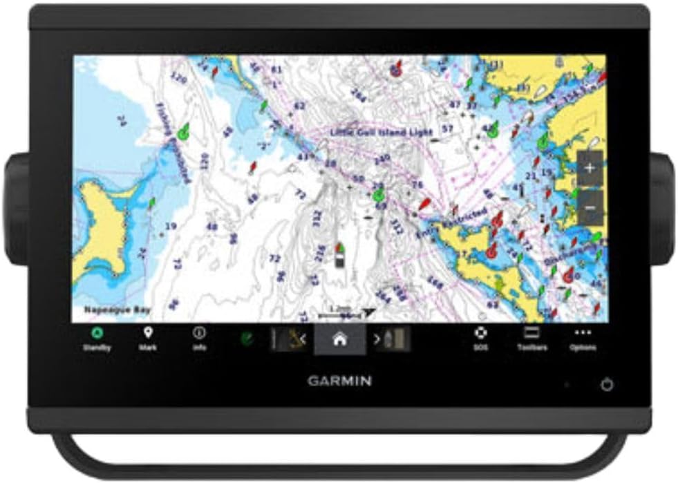
The GPSMAP 743 is a non-sonar unit focused purely on navigation and mapping. It comes with 7-inch display and Navionics+ preloaded for immediate use. The display optics are improved for better clarity and viewing angle.
We may earn a commission when you buy through this link, at no additional cost to you.
With no sonar hardware included it is simpler to install and operate. You get full mapping capabilities for plotting courses and checking tides. This model is great for sailors and cruisers who do not need fish finding.
While the screen is bright and clear, 7 inches may be small for complex routing. You miss out on underwater imaging. However the Navionics+ charts make up for this with detailed coastal data.
Ideal for boats where navigation is the priority and sonar is separate. It keeps the helm clean and functional for steering. Ensure you have separate fish finding if needed for your activities.
Dedicated navigation features reduce clutter on screen allowing for clearer route planning.
Navionics+ provides rich detail for coastal waters making safe passage easier.
We may earn a commission when you buy through this link, at no additional cost to you.
Selecting the right marine GPS depends on your specific boating style and boat size. This guide covers the key factors to consider before making a purchase.
Screen size determines how easily you can read charts and sonar at a glance. Larger displays like 12-inch models are great for fixed mounts while handhelds often have smaller screens. Look for sunlight-readable and touchscreen options for ease of use.
Prioritize brightness and clarity for safe navigation in bright conditions.
If you plan to fish, check if the unit includes CHIRP and SideVü sonars. Some models come with transducers while others require separate purchases. This feature adds to the overall cost but provides essential data for anglers.
Confirm that your budget allows for the full sonar setup you desire.
Many units come with preloaded maps like Navionics+ or BlueChart g3. These charts offer detailed coastal and inland water data. Ensure the coverage includes your local waters and any regions you plan to visit.
Verify if you need to buy additional chart cards for expanded coverage.
Modern GPS units support Wi-Fi, Bluetooth, and NMEA 2000 for networked systems. This allows you to connect to autopilots, sensors, and mobile devices. Seamless integration is key for managing complex marine electronics networks.
Choose a unit that supports your existing boat systems and upgrades.
Marine electronics must withstand salt water and sun. Look for waterproof ratings and rugged construction especially for handhelds. Units that float can prevent loss if dropped overboard.
Invest in build quality that matches your environment.
Handhelds rely on internal or AA batteries so check run times. Fixed units use boat power but consider backup options for safety. Long battery life ensures you remain navigated during extended trips.
Check battery type and expected life before committing to a model.
Interfaces should be intuitive with clear menus and physical buttons. Touchscreens are popular but physical controls work better in wet conditions. Ease of use impacts how quickly you can access data while underway.
Select a system that fits your comfort level with technology.
Prices vary widely from affordable handhelds to premium combos. Consider what features you truly need to avoid overspending. Higher cost often means better sonar and screen quality.
Balance price with functionality to find the best value for your boat.
Begin by installing the unit securely and ensuring it has access to the sky for GPS signals. Connect any sonar transducers according to the manual to get accurate data immediately. Calibrate the compass if required for precise heading tracking.
Familiarize yourself with the chart loading and route planning features. Create waypoints for common spots to simplify your navigation next time. Use the touchscreen or buttons to mark routes efficiently.
Clean the display with a soft cloth after each use to remove salt spray. Store handhelds in a dry place away from extreme heat. Regular updates ensure your maps stay current with new data.
Many units come with preloaded charts but detailed coastal areas may require separate cards. Check the product specs to see what is included before purchase. Some systems allow digital chart updates via Wi-Fi or SD cards.
GPS tracks position while a chartplotter displays that position on a map. Modern units combine both for navigation and safety. Most options today are chartplotters with built-in GPS receivers.
Handheld models run on batteries and work without hard wiring. Fixed units require a boat power source. If your boat has no electrical system choose a battery-powered handheld option for flexibility.
Most marine GPS units are water-resistant and can handle rain and splashes. Handhelds often float and are designed to survive immersion. Check the IP rating for specific protection levels before buying.
Update your charts at least once a year to reflect changes in the environment. Most systems allow wireless updates via a mobile app. Regular updates ensure you have the latest safe passages.
Some models include a transducer while others require you to buy one separately. Check if your selected bundle has one before purchase. Ensure compatibility with your unit before installing.
We reviewed ten top units from compact handhelds to advanced combos with radar. The Garmin ECHOMAP UHD2 and Simrad GO offer great value for most boaters. For premium needs the GPSMAP 1223xsv delivers unmatched performance.
Prioritize display quality and connectivity that match your boat's size. Handhelds serve as great backups while fixed units handle complex routing. Focus on the features you need most daily.
Prices change regularly so check current listings before buying. Use this guide to find a model that fits your budget and requirements. Safe travels await with the right navigation system in place.